Get a related visualization
URL: https://daac.ornl.gov/ABOVE/guides/AirSWOT_Orthomosaic_WaterMask_Fig1.png
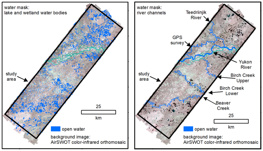
AirSWOT water masks for lakes and wetlands (left) and river channel reaches (right) in the ~3,300 km2 Yukon Flats Basin study area. Image is from Pitcher et al. (2019).
There are no views created for this resource yet.
Additional Information
| Field | Value |
|---|---|
| Data last updated | November 12, 2020 |
| Metadata last updated | November 20, 2025 |
| Created | November 12, 2020 |
| Format | PNG |
| License | License not specified |
| Datastore active | False |
| Has views | False |
| Id | 5b19518b-aa4e-4fe0-90cd-1c26d12ae4ed |
| Mimetype | image/png |
| Package id | 30ab3608-e544-42c7-b18c-f7cd81d155e1 |
| Position | 11 |
| State | active |