Get a related visualization
URL: https://daac.ornl.gov/ABOVE/guides/Annual_Thaw_Slump_Fig1.PNG
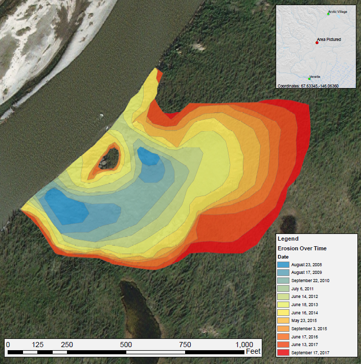
Annual expansion of a thaw slump on the East Fork Chandalar River near the community of Venetie, Alaska, from 2008 through 2017. The erosion time series was created by manually digitizing from ESRI basemap and Landsat 5, 7, and 8 imagery. The eroded area appears to be growing steadily, mostly to the east, with apparent limitation on growth to the north and south. Source: Thaw_Slump_Images.pdf companion file.
There are no views created for this resource yet.
Additional Information
| Field | Value |
|---|---|
| Data last updated | November 12, 2020 |
| Metadata last updated | November 20, 2025 |
| Created | November 12, 2020 |
| Format | PNG |
| License | License not specified |
| Datastore active | False |
| Has views | False |
| Id | 3e04eb8b-80c0-4345-9eab-55347b37f226 |
| Mimetype | image/png |
| Package id | 2492ed98-3134-449e-a13e-faebc3b1ce92 |
| Position | 7 |
| State | active |