Get a related visualization
URL: https://daac.ornl.gov/CMS/guides/CMS_AGB_Landcover_Indonesia_Fig1.png
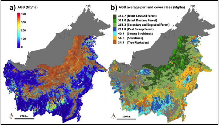
Aboveground biomass (AGB) density map of Kalimantan forests at 1-ha resolution (a) and mean AGB aggregated by land cover class (b). Land cover derived from the Indonesia Ministry of Forests map for the Indonesian portion of the Island of Borneo (Ferraz et al., 2018).
There are no views created for this resource yet.
Additional Information
| Field | Value |
|---|---|
| Data last updated | November 12, 2020 |
| Metadata last updated | November 22, 2025 |
| Created | November 12, 2020 |
| Format | PNG |
| License | License not specified |
| Datastore active | False |
| Has views | False |
| Id | 38de98e0-2c33-48eb-bdde-cb1a9ac73191 |
| Mimetype | image/png |
| Package id | 7ea7e914-449e-47bc-963c-98d23d06e213 |
| Position | 6 |
| State | active |