Seismic Line Locations.jpg
URL: https://gdr.openei.org/files/1011/SeismicLineLocations.jpg
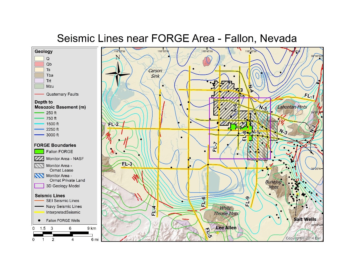
Generalized geologic map of the FORGE area near Fallon, NV, showing locations of interpreted seismic reflection profiles (red and black seismic lines highlighted in yellow to show areas interpreted), Quaternary faults (red lines), and depth of Mesozoic basement. The FORGE area is in green and surrounding monitor areas are shown by gray hashes. Black dots are wells with available data from logs, cuttings, or core.
Additional Information
| Field | Value |
|---|---|
| Data last updated | January 11, 2025 |
| Metadata last updated | September 24, 2025 |
| Created | January 11, 2025 |
| Format | JPEG |
| License | Creative Commons Attribution |
| Datastore active | False |
| Has views | True |
| Id | 3d553f45-4576-420c-b9f0-7efca1aada7b |
| Mimetype | image/jpeg |
| Package id | 24614a48-ffbe-43c3-85db-4324528cb405 |
| Position | 1 |
| State | active |